
Environmental Destination
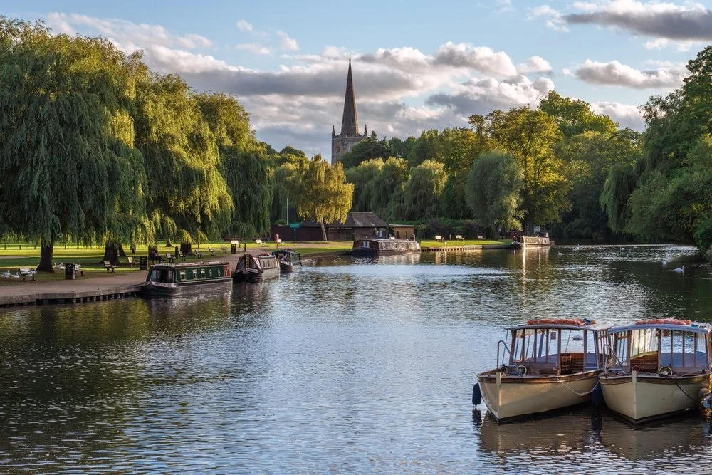
Warwickshire Avon
The Warwickshire Avon management catchment stretches from the river’s source east of Rugby to where it meets the River Severn near Tewkesbury. The area is mainly rural, with arable farming, livestock grazing, horticulture and market gardening around Evesham. Towns including Coventry, Redditch, Rugby, Stratford‑upon‑Avon, Tewkesbury and Warwick add important cultural and economic value to the area. The river and its surroundings support a wide range of protected habitats and species.
Water resources play a significant strategic and environmental role within the catchment. The River Avon supplies Draycote Reservoir, and the region’s aquifers provide an important source of drinking water. Water is also abstracted for agriculture, industry and other uses. The catchment contains numerous surface waterbodies and Sites of Special Scientific Interest (SSSIs), showing its rich environmental importance. Rivers, wetlands and riverbanks also offer recreational space and support local wellbeing.
For our Environmental Destination (ED) programme, we are focusing on a specific “area of interest” within the catchment, relevant to water company abstractions. Our focus is those surface water bodies where the public water supply companies actively abstract water or where their groundwater abstraction impacts on flow to surface waterbodies. The area of interest includes the waterbodies which overlie the Permo-Triassic sandstone, coal measures and limestone groundwater bodies. It also includes the waterbodies surrounding the River Avon.
Please note the correct WFD management catchment name for this catchment is ‘Avon Warwickshire’, we are referring to it as the Warwickshire Avon as this is how it is commonly referred to and this is the name used for the catchment by the Environment Agency.
Thank you for your help!
Thank you to everyone who contributed to the Idle and Torne & Lower Trent and Erewash workshop held on 16 July 2026 at Wilmcote Village Hall. Your local knowledge, practical experience, and on‑the‑ground perspectives were invaluable in helping us build a more informed and accurate understanding of the catchment.
Warwickshire Avon slide pack
Warwickshire Avon priority areas
What are our objectives and investigations?
Understand what river flow targets and changes to water abstraction may be needed to support a healthy water environment in the Warwickshire Avon.
Check how well the Environment Agency’s national modelling reflects local conditions. You can view their modelling in the Modelled Abstraction Reductions – National Framework for Water Resources 2025.
Compare the national modelling with improved local data to make sure we’re getting an accurate picture of the catchment and its needs.
Explore options to improve and protect river flows, including reducing our own abstractions where necessary. We’ll also look for opportunities to work with local partners and develop Nature‑Based Solutions (NBS) that strengthen the catchment’s resilience.
Use the evidence gathered to build confidence in any future abstraction changes, helping us prioritise actions and plan a realistic timeline for making improvements.
Feed into the development of our regional plan and our member’s Water Resources Management Plans (WRMPs), which outlines how we will meet long‑term challenges such as population growth, drought, environmental pressures and climate change, while ensuring a reliable water supply. The plan is being developed alongside the Water Resources West Regional Plan, which sets out how all abstractors in the region will work together to secure water supplies over the next 60 years. The first plan was published in June 2025 and is available here: Water Resources West Final Regional Plan — Water Resources West.
We would like to hear from you
Please complete the contact form below, letting us know things like: Do you want to partner with Nature Based Solutions? Are you already working on something in your area? Do you have any evidence of the catchment that you would like to share? Can you let us know the grid reference of the location you are referring to? What is your interest in the catchment? Do you have any thoughts you would like to share on our investigations?
If you would like to know a bit more about the data we are using for these investigations, below are the data sources we have used:
EA catchment data explorer: England | Catchment Data Explorer
Provides data used by EA in River Basin Management Plans
EA Environmental Destination Catchment Summaries: Catchment Summaries | Environmental Destination - Get involved! | Engage Environment Agency
Information to help understand the water resources challenge in local catchments
Modelled Abstraction Reductions - National Framework for Water Resources 2025: Modelled Abstraction Reductions - National Framework for Water Resources 2025
A spreadsheet showing a range of potential reductions to abstraction licence quantities which may be needed to meet environmental flow requirements