
Environmental Destination
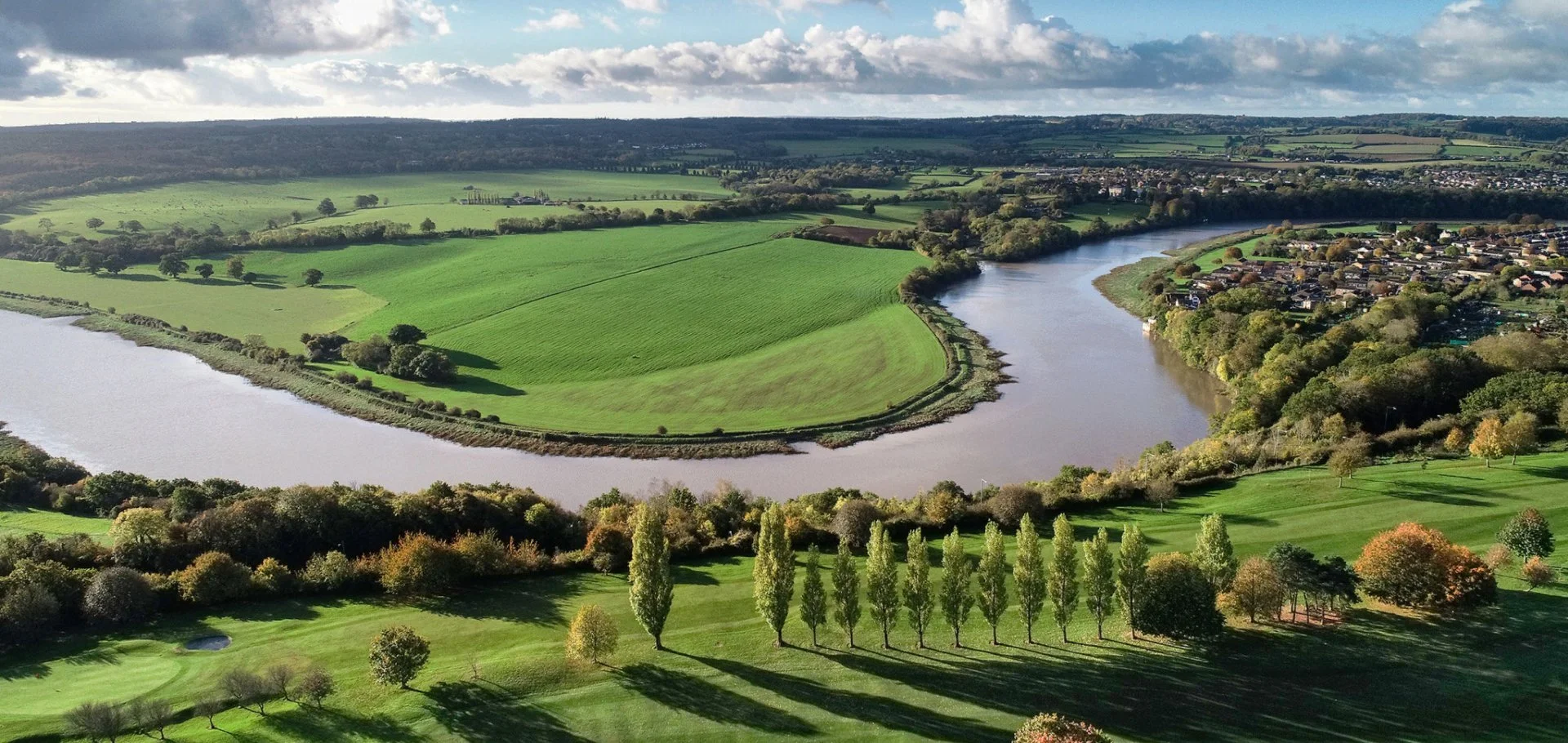
Severn Vale
The Severn Vale management catchment covers the lower River Severn and its network of tributaries, including the Leadon, Chelt, Frome, Cinderford Brook and Cannop Brook. These rivers flow into the nationally and internationally important Severn Estuary, which is protected for its wildlife and habitats. The River Severn also supports recreation, navigation and local heritage, making it an important environmental and community asset.
The catchment spans a diverse landscape, with water flowing in from the Malvern Hills, the Cotswolds, the Forest of Dean and the Frome catchment. It includes towns such as Gloucester, Cheltenham, Stroud, Cinderford and Ledbury, alongside farmland, woodland and estuarine areas. There are numerous surface waterbodies and many designated nature sites, reflecting both the ecological value of the area and the pressures it faces.
The Severn Vale Catchment Partnership (SVCP) has identified several challenges, including low river flows, barriers to fish movement, flooding, habitat loss and water quality issues. Previously, many projects were small and disconnected, making it harder to tackle these wider pressures. The partnership is now shifting towards more strategic, catchment‑wide programmes that bring organisations together and support larger‑scale improvements.
Successful projects—such as recent work on Cinderford Brook—show what can be achieved through strong local engagement. New partnership priorities, including programmes like Wilder Frome, Forest to Sea and Wilder Leadon, present opportunities for more joined‑up action to improve river health, restore habitats and strengthen the long‑term resilience of the Severn Vale catchment.
For our Environmental Destination (ED) programme, we are focusing on a specific “area of interest” within the catchment, relevant to water company abstractions. Our focus is those surface water bodies where the public water supply companies actively abstract water or where their groundwater abstraction impacts on flow to surface waterbodies. Severn Trent has ground water abstractions in the Frome and Cam, Forest of Dean, Leadon and Seven River and Trib Operational catchments and its investigation will be confined within these catchments of the larger Severn Vale management catchment.
Thank you for your help!
Thank you to everyone who contributed to the Severn Vale workshop held on 08 July 2026 at Upton Magna Memorial Hall. Your local knowledge, practical experience, and on‑the‑ground perspectives were invaluable in helping us build a more informed and accurate understanding of the catchment.
Once we have incorporated all of your insightful feedback we will play this back to you in the Autumn.
Until then here are the slides that we shared at the workshop:
What are our objectives and investigations?
Understand what river flow targets and changes to water abstraction may be needed to support a healthy water environment in the Severn Vale.
Check how well the Environment Agency’s national modelling reflects local conditions. You can view their modelling in the Modelled Abstraction Reductions – National Framework for Water Resources 2025.
Compare the national modelling with improved local data to make sure we’re getting an accurate picture of the catchment and its needs.
Explore options to improve and protect river flows, including reducing our own abstractions where necessary. We’ll also look for opportunities to work with local partners and develop Nature‑Based Solutions (NBS) that strengthen the catchment’s resilience.
Use the evidence gathered to build confidence in any future abstraction changes, helping us prioritise actions and plan a realistic timeline for making improvements.
Feed into the development of our regional plan and our member’s Water Resources Management Plans (WRMPs), which outlines how we will meet long‑term challenges such as population growth, drought, environmental pressures and climate change, while ensuring a reliable water supply. The plan is being developed alongside the Water Resources West Regional Plan, which sets out how all abstractors in the region will work together to secure water supplies over the next 60 years. The first plan was published in June 2025 and is available here: Water Resources West Final Regional Plan — Water Resources West.
We would like to hear from you
Please complete the contact form below, letting us know things like: Do you want to partner with Nature Based Solutions? Are you already working on something in your area? Do you have any evidence of the catchment that you would like to share? Can you let us know the grid reference of the location you are referring to? What is your interest in the catchment? Do you have any thoughts you would like to share on our investigations?
If you would like to know a bit more about the data we are using for these investigations, below are the data sources we have used:
EA catchment data explorer: England | Catchment Data Explorer
Provides data used by EA in River Basin Management Plans
EA Environmental Destination Catchment Summaries: Catchment Summaries | Environmental Destination - Get involved! | Engage Environment Agency
Information to help understand the water resources challenge in local catchments
Modelled Abstraction Reductions - National Framework for Water Resources 2025: Modelled Abstraction Reductions - National Framework for Water Resources 2025
A spreadsheet showing a range of potential reductions to abstraction licence quantities which may be needed to meet environmental flow requirements