
Environmental Destination
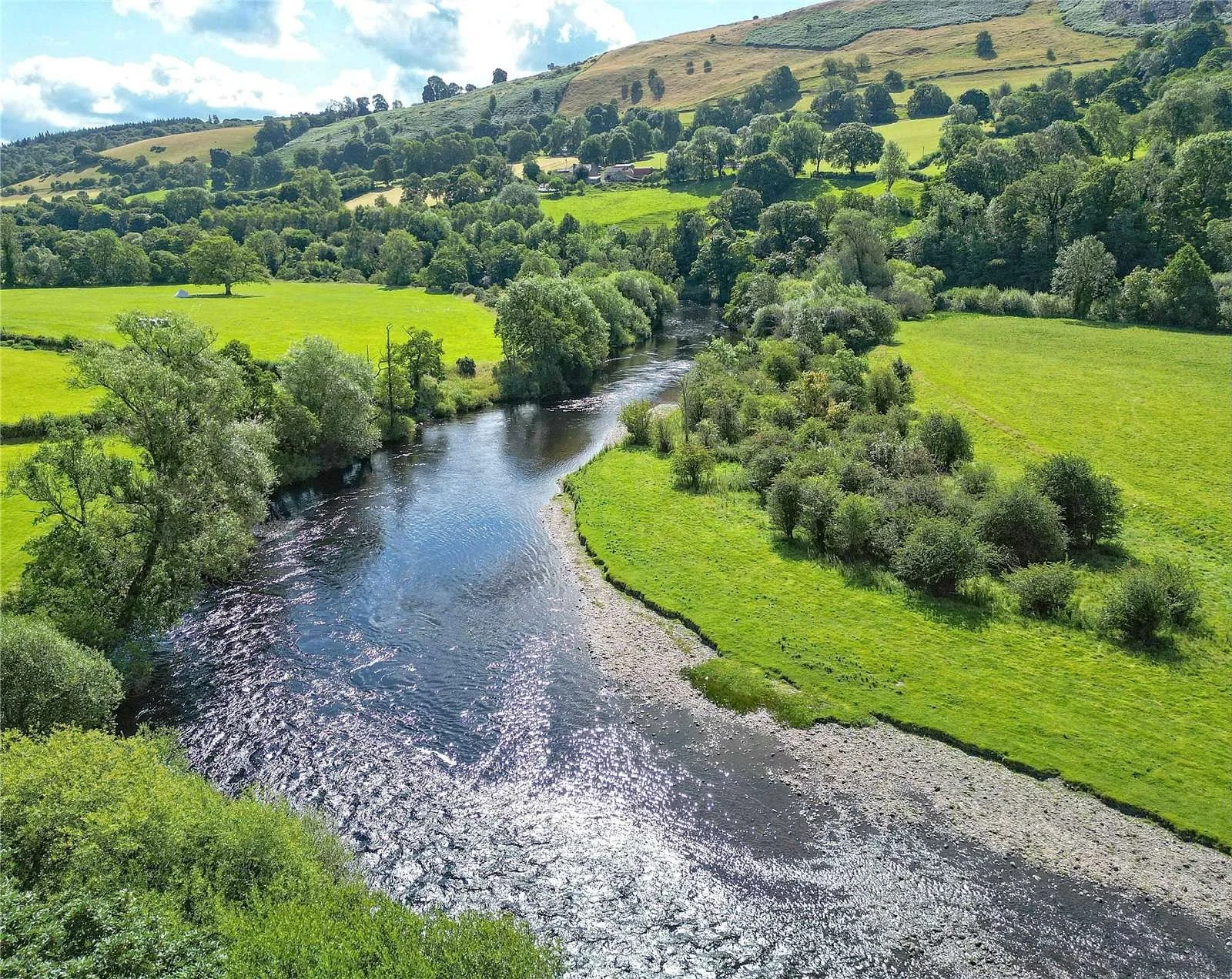
Dee
The Dee Water Framework Directive (WFD) Management Catchment is a landscape of real contrasts, stretching across the border of England and Wales and linking the mountains of Eryri (Snowdonia) to the open plains of Cheshire and the wild mudflats of the Dee Estuary. There are thriving communities such as Chester, Wrexham and Whitchurch, as well as a vast range of farmland, woodlands, canals and wildlife‑rich waterways.
For our Environmental Destination (ED) programme, we are focusing on a specific “area of interest” within the catchment, relevant to water company abstractions. Our focus is those tributaries in England where the public water supply companies actively abstract water or where their groundwater abstraction impacts on flow to surface waterbodies. These four water bodies are Morlas Brook, Shell Brook, Worthenbury Brook (Worthenbury Lower) and Aldford Brook—and they represent the full character of the Dee system, from fast‑flowing upland rivers to peaceful lowland streams weaving through agricultural landscapes. Some influencing abstractions sit just outside the Dee catchment, so we’ll also be working closely with neighbouring catchments to make sure our efforts are joined‑up – specifically the Severn Middle Shropshire and the Weaver Gowy management catchments.
This is an area rich in special habitats, including Sites of Special Scientific Interest (SSSIs) such as Shell Brook Pastures and the Afon Dyfrdwy (River Dee) itself. Local authorities manage many of the smaller watercourses, and the much‑loved Llangollen Canal adds heritage and recreational value. All of this work is supported by the Middle Dee Catchment Partnership—a collaboration of farmers, communities, environmental groups and local organisations who share a common goal: a cleaner, healthier, wildlife‑rich water environment. Through shared evidence, coordinated action and community involvement, the partnership is working to enhance biodiversity, support sustainable land management and ensure the Dee catchment continues to thrive for both people and nature.
Thank you for your help!
Thank you to everyone who contributed to the Idle and Torne & Lower Trent and Erewash workshop held on 1 July 2026 at Huxley Village Hall Village Hall. Your local knowledge, practical experience, and on‑the‑ground perspectives were invaluable in helping us build a more informed and accurate understanding of the catchment.
Once we have incorporated all of your insightful feedback we will play this back to you in the Autumn.
Dee and Weaver Gowy workshop slides
Dee and Weaver Gowy appendices (priority catchments)
What are our objectives and investigations?
Understand what river flow targets and changes to water abstraction may be needed to support a healthy water environment in the Dee.
Check how well the Environment Agency’s national modelling reflects local conditions. You can view their modelling in the Modelled Abstraction Reductions – National Framework for Water Resources 2025.
Compare the national modelling with improved local data to make sure we’re getting an accurate picture of the catchment and its needs.
Explore options to improve and protect river flows, including reducing our own abstractions where necessary. We’ll also look for opportunities to work with local partners and develop Nature‑Based Solutions (NBS) that strengthen the catchment’s resilience.
Use the evidence gathered to build confidence in any future abstraction changes, helping us prioritise actions and plan a realistic timeline for making improvements.
Feed into the development of our regional plan and our member’s Water Resources Management Plans (WRMPs), which outlines how we will meet long‑term challenges such as population growth, drought, environmental pressures and climate change, while ensuring a reliable water supply. The plan is being developed alongside the Water Resources West Regional Plan, which sets out how all abstractors in the region will work together to secure water supplies over the next 60 years. The first plan was published in June 2025 and is available here: Water Resources West Final Regional Plan — Water Resources West.
We would like to hear from you
Please complete the contact form below, letting us know things like: Do you want to partner with Nature Based Solutions? Are you already working on something in your area? Do you have any evidence of the catchment that you would like to share? Can you let us know the grid reference of the location you are referring to? What is your interest in the catchment? Do you have any thoughts you would like to share on our investigations?
If you would like to know a bit more about the data we are using for these investigations, below are the data sources we have used:
EA catchment data explorer: England | Catchment Data Explorer
Provides data used by EA in River Basin Management Plans
EA Environmental Destination Catchment Summaries: Catchment Summaries | Environmental Destination - Get involved! | Engage Environment Agency
Information to help understand the water resources challenge in local catchments
Modelled Abstraction Reductions - National Framework for Water Resources 2025: Modelled Abstraction Reductions - National Framework for Water Resources 2025
A spreadsheet showing a range of potential reductions to abstraction licence quantities which may be needed to meet environmental flow requirements